stripes
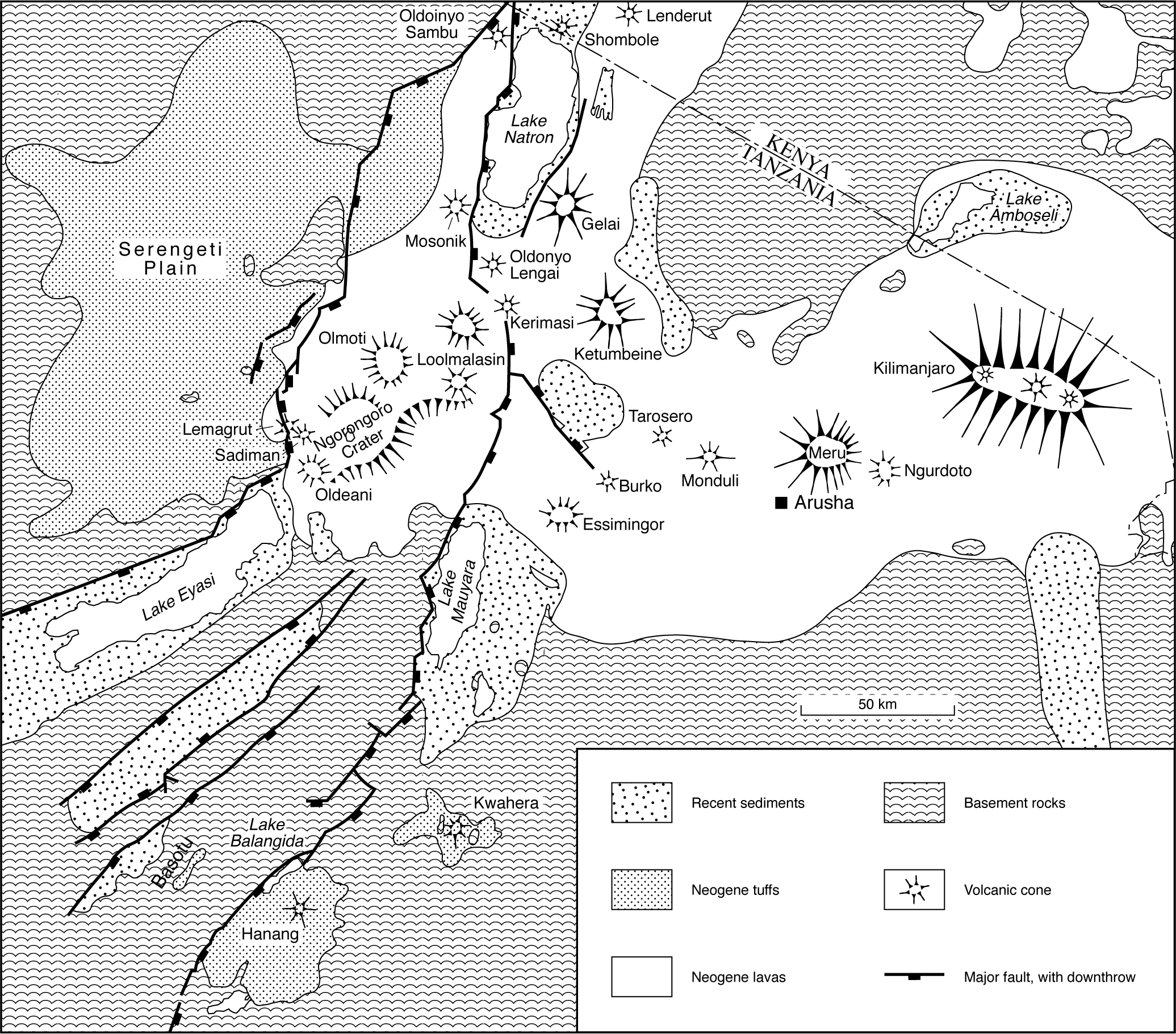
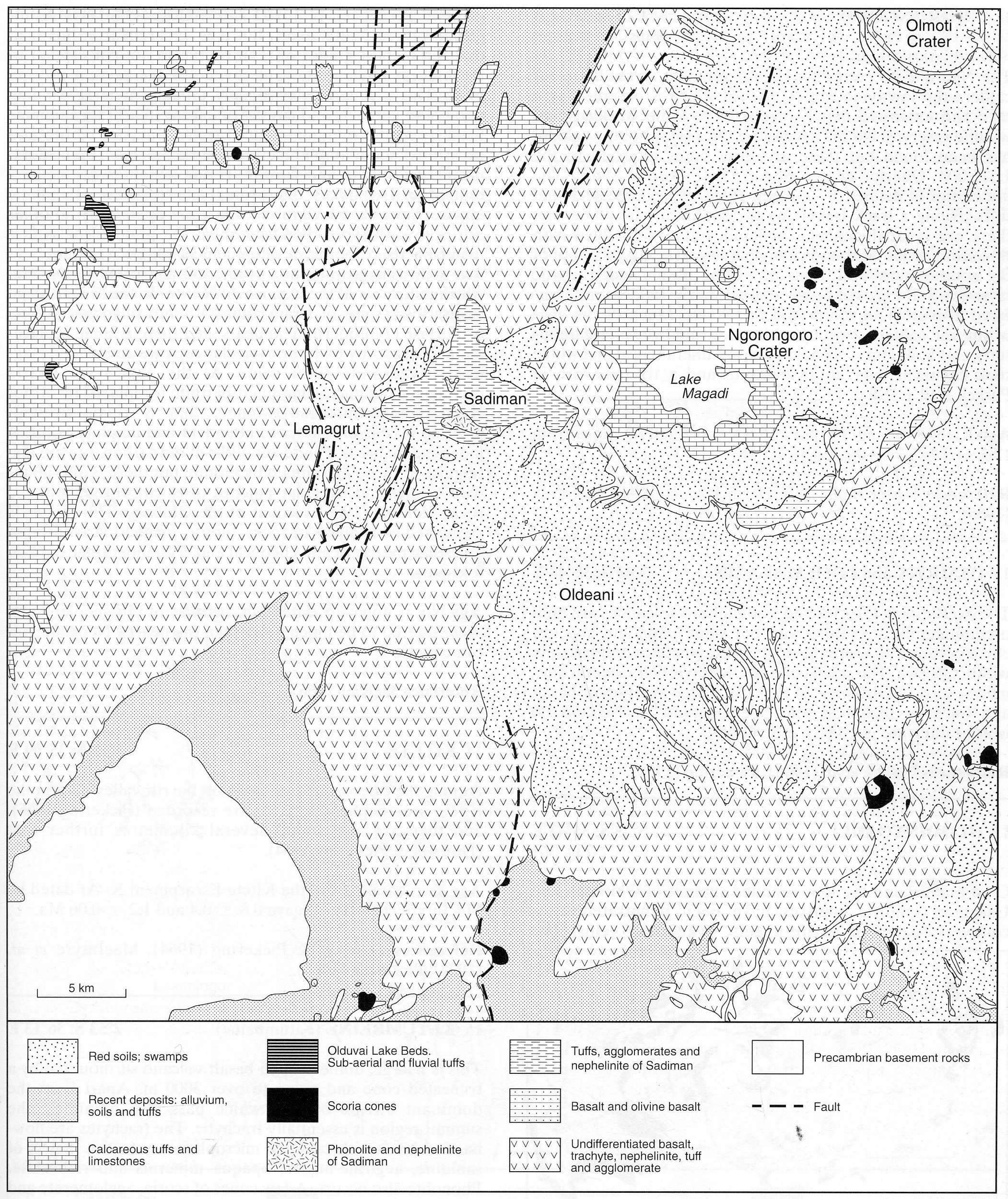
The Ngorongoro crater is an approximately 20 km diameter caldera the low lying central part of which is occupied by a lake and extensive marsh that is one of the world’s great wildlife reserves. No full account of the geology of the caldera has been found but there are brief notes attached to the 1:125,000 ‘Quarter degree Sheet 53’ (Pickering, 1965). The crater rim is defined by a steep ridge of agglomerates and tuffs. Along a track traversing the southern part of the rim there are great thicknesses of lapilli tuffs interbedded with thin scoriaceous lavas and cut by basaltic dykes. At the foot of the southeastern wall areas of olivine basalt and trachytic lavas form ill-exposed areas and within the caldera are scattered a number of scoria and tuff cones. Much of the area within the caldera is occupied by grey and brown calcareous tuffs, clay soils and seasonal swamps. Mineralogical and whole rock chemical data, for a basanite and a trachyte, are in Paslick et al. (1996).
FOSTER, A., EBINGER, C., MBEDE, E. and REX, D. 1997. Tectonic development of the northern Tanzanian sector of the East African rift system. Journal of the Geological Society of London, 154: 689-700.PASLICK, C., HALLIDAY, A.N., JAMES, D. and DAWSON, J.B. 1996. Indirect crustal contamination: evidence from isotopic and chemical disequilibrium in minerals from alkali basalts and nephelinites from northern Tanzania. Contributions to Mineralogy and Petrology, 125: 277-92.PICKERING, R. 1965. Ngorongoro. Geological Survey of Tanzania, Quarter Degree Sheet, 53.