stripes
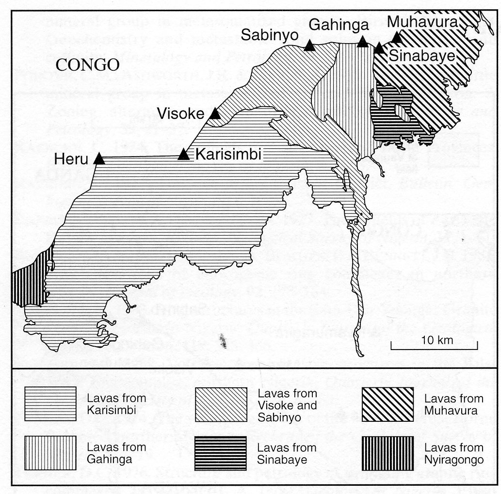
Muhavura (4127 m) is the most easterly of the Virunga volcanoes, the northern half of which lies in Uganda and forms part of the Bufumbira field (Uganda 8). A subsidiary peak, Sinabaye, lies west-southwest of the summit of Muhavura and the border with Uganda is drawn between them. On the geological map of Antun et al. (1971) Muhavura is indicated as consisting predominantly of flows of kivite and leucite basanite with lesser areas of absarokite, some tending towards murumbite, and leucite nephelinite. There are restricted areas of sediments of volcanic origin. Rogers et al. (1998) used a simple nomenclature for the rocks based on the total alkalis - silica diagram and thus classified the rocks of Muhavura (and Gahinga - No. 2) as ranging from K-basalt and K-basanite through K-hawaiite and K-mugearite to K-benmoreite. According to their general petrographic description of these two volcanoes the lavas are rich in phenocrysts, up to 5 mm in diameter, of plagioclase, titaniferous clinopyroxene, olivine (Fo70+), iron oxide and leucite (modally 0-10%) set in a glassy to finely crystalline matrix. Xenocrysts of mica and amphibole are found in some rocks. 11 rock analyses are given in Denaeyer and Schellinck (1965). Rogers et al. (1998) present 16 rock analyses, including many trace elements and Pb, Sr and Nd isotope data, and discuss at length the geochemistry and petrogenesis of the volcano.
ANTUN, P., BERTOSSA, A., DELHAYE, F., PEETERS, L., PETRICEC, V., SALEE, A. and WALEFFE, A. 1971. Carte géologique du Rwanda. Feulle Ruhengeri Nord (S2/29 NW et NE). 1:100,000. Institut Géographique Militaire de Belgique.DENAEYER, M-E. and SCHELLINCK, F. 1965. Recueil d’analyses des laves du fosse tectonique de l’Afrique Centrale. Annales, Museee Royal de l’Afrique Centrale, Tervuren, Belgique. Serie In 8°, Sciences Géologiques, 49: 1-234.ROGERS, N.W., JAMES, D., KELLEY, S.P. and MULDER, M. de 1998. The generation of potassic lavas from the eastern Virunga Province, Rwanda. Journal of Petrology, 39: 1223-47.