stripes
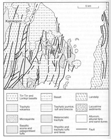
The Namarunu volcano abuts the western margin of the rift in the northern part of the Maralal area (No. 085-00-011) and extends northwards into the Loiyangalani area (No. 085-00-07). It forms a broad shield the predominant basal part of which consists of at least 200 m of outward dipping trachytic lavas, breccias and tuffs with minor mugearite and benmoreite (Dunkley et al., 1993). The pyroclastic rocks include pumice lapilli tuffs with intensely welded glassy bands exhibiting rheomorphic features. These rocks are overlain unconformably by basalts. There was then a long time interval before emplacement of rhyolitic and trachytic lavas and pyroclastics that form a prominent hill northwest of the summit. There followed a suite of melanocratic trachyte lavas, trachytic pumice lapilli tuffs and breccias and a final upper basalt sequence with associated scoria and spatter cones. Petrographic details of the rocks have not been traced. Some fine aerial photographs are given by Dunkley et al. (1993) who also describe in detail the geothermal activity of the area, and include a detailed geological map in colour on a scale of 1:50,000.
DUNKLEY, P.N., SMITH, M., ALLEN, D.J. and DARLING, W.G. 1993. The geothermal activity and geology of the northern sector of the Kenya rift valley. British Geological Survey, Research Report. International Series SC/93/1: 1-185.KEY, R.M. 1987b. Geology of the Maralal area. Report, Geological Survey of Kenya, 105: 1-93.

